Roman Aqueducts Engineering Secrets: How Water Moved Uphill
Roman Aqueducts Engineering Secrets were never mystical tricks. They were a marriage of terrain reading, geometry, and relentless maintenance. From the city’s mythic birth to imperial grandeur, Rome’s water network shaped politics, hygiene, and daily life. If you want the cultural backstory, explore the foundation of Rome from Aeneas to Romulus and Remus and the political roots in the Seven Kings of Rome. In this guide, we unpack the gradients, siphons, and surveying tools that let gravity do the heavy lifting—and made stone flow like water.
Historical Context
From Hills and Springs to an Engineered Capital
Rome grew on seven hills beside reliable springs, but growth outpaced what wells and cisterns could offer. The first conduit, Aqua Appia (312 BCE), ran mostly underground for protection and steady temperature. Over the next centuries, the state layered aqueduct after aqueduct—Marcia, Claudia, Anio Novus—each tapping cleaner, higher sources. Roman Aqueducts Engineering Secrets began with topography: capture water at a higher elevation than the city’s distribution tanks, keep a gentle, continuous slope, and protect the channel inside vaults when needed. For an accessible technical overview, see the Britannica entry on aqueduct engineering, which clarifies how gravity, not pumps, powered most flows.
Frontinus and the System Behind the Arches
By the first century CE, Rome’s network was a public utility with inspectors, law, and ledgers. The water commissioner Sextus Julius Frontinus documented sources, capacities, and abuses in De aquaeductu. His treatise shows a city that measured leakage, enforced easements, and redesigned routes after floods or landslides. It also reveals meticulous surveying and material choices—pozzolanic concrete, cut-stone channels, and lead or terracotta pipes at junctions. The best window into the bureaucracy and the math is Frontinus’ De aquaeductu (English translation). Read it, and the arches become less romantic silhouette and more a ledger of gradients, gates, and workforce routines.
Key Facts and Eyewitness Sources
Gravity, Not Magic: The “Uphill” Illusion Explained
People often ask how Romans made water run “uphill.” The short answer: they didn’t—at least not beyond the elevation of the source. Channels were laid at tiny but constant slopes, often between 0.1% and 0.3%, so water flowed steadily. When a valley interrupted the route, engineers built an inverted siphon: the pipe dove down one hillside, crossed the valley floor, then rose the opposite slope to a point still below the intake head. Hydrostatic pressure pushed the column up because the outlet remained lower than the header tank. Understanding these pressure lines is part of Roman Aqueducts Engineering Secrets, and it means “uphill” was an optical trick produced by valleys and arches, not sorcery.
Surveying Tools: Chorobates, Groma, and Dioptra
Precision starts with line and level. Surveyors used the chorobates, a five-meter wooden bench with plumb lines and a spirit-level channel, to establish minute gradients over long distances. The groma set right angles for alignments and town grids. The dioptra—a sort of classical theodolite—helped sight lines across valleys and adjust the slope to the terrain’s constraints. These instruments enabled highly consistent drops over tens of kilometers. Roman teams then translated those sighted lines into trench depth, pier height, and vault springing. The result was not a miracle but repeatable survey math executed by well-trained crews and checked against benchmarks.
Frontinus’ Rome: Capacities, Theft, and Maintenance
Frontinus describes named conduits feeding castella (distribution tanks) through gates and calibrated orifices. Officials tracked allocations to public baths, fountains, and private users. He fought illegal spurs—citizens bored into pipes to steal flow—and instituted repairs after floods. Teams of aquarii and limarii scraped mineral deposits, cleared silt traps, and relined mortar. Stone boundary markers (cippi) protected easements. One striking fact is how often maintenance, not construction, occupies the text. Understanding Roman Aqueducts Engineering Secrets is as much about sludge, lime scale, and law as it is about arches in the sky.
Analysis / Implications
Why the Math Matters: Gradients and Pressures
At the core of Roman Aqueducts Engineering Secrets lies a clean equation: potential energy from elevation drives flow. Keep the slope small to avoid scouring the channel; too steep, and turbulence erodes masonry; too flat, and velocity drops, letting sediment settle. Inverted siphons concentrated pressure at the valley floor where pipes needed thicker walls and tight joints. Romans learned to mix pozzolana and lime for waterproof mortar and to alternate materials—stone channels for open flow, lead or terracotta pipes where pressure demanded a closed conduit. The network worked because each choice matched a number: head, drop, velocity, and stress.
Urban Life, Social Order, and Public Health
Water policy shaped the city. Fountains democratized access, baths structured schedules, and urban fire-fighting relied on pressure points and reservoirs. After disasters, reforms touched water too—Nero’s rebuilding following the conflagration (see the Great Fire of Rome) included street widening that affected conduit routes and hydrant placement. When supply faltered, civic confidence wobbled; when it surged, prosperity and craft guilds flourished. During crises like the Sack of Rome in 410, aqueducts were strategic targets because water is morale and logistics. The system was an invisible constitution binding rulers and residents to a daily promise: turn the spout, and water appears.
Case Studies and Key Examples
Aqua Appia, Marcia, and Claudia: A Progressive Toolkit
Aqua Appia (312 BCE) set the pattern—mostly subterranean for security and steady temperature.
Aqua Marcia (2nd century BCE) chased purer sources across ~90 km, famed for cold, clear water.
Aqua Claudia (1st century CE) rode monumental arcades across approaches to the city, then slipped underground again toward distribution tanks.
Combined, they show modular thinking: when terrain was safe, go underground; where valleys demanded, rise on arches. The gradients were tiny, so builders controlled every centimeter of drop with careful pier spacing and vault heights. These corridors also served inspection—that constant, unglamorous duty at the heart of a resilient network.
Pont du Gard and the Nîmes Aqueduct: Precision over Spectacle
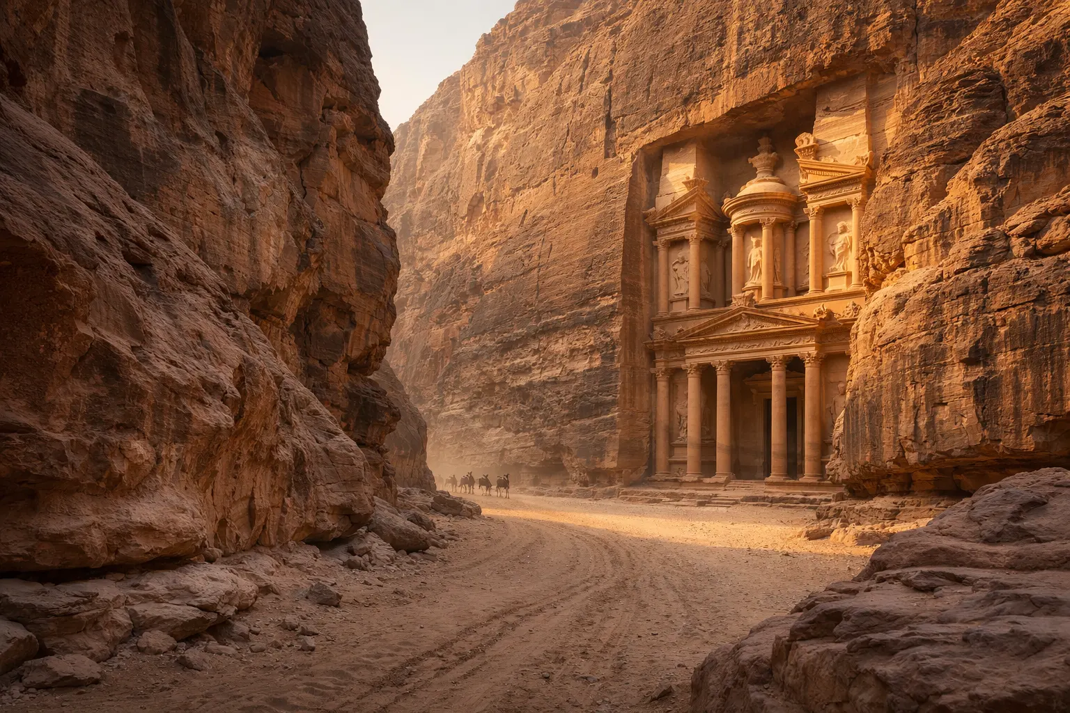
The aqueduct to Nemausus (Nîmes) descended only a few dozen meters across roughly 50 km, a slope so slight that a single misread could stall flow. Pont du Gard’s three-tier limestone bridge shows how a valley crossing becomes architecture without breaking the math. Channels ran with enough clearance to shed turbulence, while stilling basins calmed water before reentry to buried conduits. These sites showcase Roman Aqueducts Engineering Secrets in stone: continuous gradient, tight joints, and careful transitions between open and closed flow. For a broader sense of ancient engineering prestige, see the Seven Wonders of the Ancient World.
Lugdunum’s Gier Aqueduct: The Inverted Siphon in Action
Where a valley was too deep for practical arcades, Romans laid pressure pipes across the floor and up the opposite side, fed by a header tank. Lugdunum (Lyon) mastered this with the Gier aqueduct, including multiple inverted siphons and robust stone supports for pipe runs. Lead and terracotta piping took the interior pressures, while distribution towers (castella) bled off energy and separated silt upstream. Modern readers find the sight counterintuitive—water “climbing”—but the outlet sat below the header level, so the energy budget always balanced. For a modern comparison of civic prestige projects, consider the Seven Wonders of the Modern World.
Key Facts and Eyewitness Sources (continued)
Materials and Construction: Why It Lasted
Romans favored hydraulic mortars that hardened underwater, especially those made with volcanic ash. Inside channels, they troweled opus signinum, a waterproof lining of crushed tile and lime. Arches were calculated to carry thrust into piers without cracking the conduit. Where spring water was aggressive, builders used stone slabs or terracotta to avoid lead corrosion. Expansion and contraction were mitigated with joints and occasional settling basins that doubled as access points. Many structures still stand because chemistry met geometry: materials chosen for flow chemistry, and forms chosen for predictable load paths. Durability was not an accident—it was policy.
Distribution: Castella, Calibrated Orifices, and Social Priorities
Water entered castella on hilltops, then split through bronze or lead calices—nozzles with known apertures that rationed flow to baths, fountains, and private users. Public needs came first: street fountains (lacus) and bath complexes guaranteed a visible dividend from taxation. Private grants required imperial permission and could be revoked if abuse was detected. Frontinus’ tables of allocations show a city that counted every drop. The story here is technology enabling policy: measurement created accountability, accountability created trust, and trust justified expansion. It’s infrastructure as social contract rendered in stone and water.
Myth-Busting: Pumps, Water Wheels, and What They Really Used
Romans knew screw pumps and water wheels, and used them in mines and mills, but rarely for city supply. Pumps were maintenance-heavy and inefficient for long-distance lift. Instead, most long conduits were gravity-fed; short lifts occurred in special contexts—shipyards, baths, or mines—where dedicated crews could maintain machinery. When you see a line apparently going “up,” look for the reference level: if the outlet is below the source, you are seeing an inverted siphon, not a violation of physics. The cleverness was choosing when to pressure a line and when to float it gently toward the city.
Analysis / Implications (continued)
Data Discipline: Measuring, Auditing, and Improving
We would call Rome’s approach “data-driven operations.” Inspectors logged leakage, siltation rates, and seasonal variability of springs. If an intake dropped during drought, crews opened alternate channels or reduced allocations to nonessential users. Investigations into illicit taps resulted in fines and public repair campaigns. Lessons propagated: later aqueducts often site intakes in more stable strata, add redundancy, or simplify crossings. This culture of feedback explains how a city could manage multiple sources without modern pumps or sensors—paper, plumb lines, and persistence were enough.
Cities as Networks: Why Water Dictates Urban Form
Walk Rome’s streets and imagine buried conduits steering neighborhoods. Markets cluster where fountains teem; baths anchor districts because reliable inflow is guaranteed. Political power expresses itself as guaranteed public flow, and emperors advertise legitimacy with arches visible for miles. In crisis, enemies target water; in peace, the state celebrates it. That duality—vulnerability and prestige—means aqueducts are both tools and symbols. And it explains why Romans defended easements fiercely: tamper with a channel, and you tamper with the calendar of the city itself.

Case Studies and Key Examples (continued)
Numbers That Ground the Story
Aqua Appia: ~16 km, mostly subterranean. Aqua Marcia: ~91 km, prized for cold clarity. Aqua Claudia: ~69 km, with towering approaches near Porta Maggiore. The Nîmes aqueduct: ~50 km total run with a drop of only a few dozen meters. Carthage’s Zaghouan aqueduct: over 100 km, showing the method spread widely. These figures illuminate the same principle replicated across provinces: survey the source, protect the slope, and design crossings to match the valley. When you add it up, Roman Aqueducts Engineering Secrets are simply many precise decisions repeated over very long distances.
Arches, Tunnels, and the Path of Least Energy
Arches are the poster image, but tunneling mattered just as much. Crews often drove headings from both sides of a ridge, meeting in the middle by sight lines and plumb. Errors became settling basins or vents, not failures. Surface arcades were chosen when geology was unstable or when public visibility had value. In practice, a single conduit could be a catalog of solutions—tunnel through basalt, trench across clay, arch across a stream, then disappear into a walled channel. The “path of least energy” was literal: let gravity do most of the work, and protect that drop with every stone.
Culture and Prestige: Water as a Civic Promise
Monumental water was manifesto. Emperors stamped legitimacy on the skyline the way modern states cut ribbons on bridges. Baths made citizens feel the state’s presence in daily comfort; literary references to sparkling fountains were political advertisements. For cultural context beyond infrastructure, the ancient world’s prestige projects stand alongside Rome’s waterworks—browse the catalog of modern “wonders” to see how societies still measure themselves by audacity in stone and steel. The continuity is striking: big works are promises you can see, hear, and drink.
Conclusion
Water “moving uphill” was always a trick of terrain and pressure, not alchemy. Measure the land, keep a patient slope, seal the joints, and manage the network—that is the essence of Roman Aqueducts Engineering Secrets. The system bound rulers and residents into a daily pact: a city where the fountain runs is a city that works. For more Roman background, explore how law and order shaped streets in Ancient Roman crime and policing and view the bigger arc in the rise and fall of the Roman Empire. The arches endure because the math endures. Gravity has not changed, and neither has the value of getting the basics right.